Radiation Mapping Drone in Fukushima Japan
Each day we are seeing drones being used for more and more tasks throughout the world. Technology on them continues to advance, which makes them suited for more jobs than one would have ever thought possible. From search and rescue to marketing and delivery services, drones are becoming a helpful tool that many businesses are putting to use.
In 2011, the Fukushima Nuclear Power Plant in Japan suffered major damage that was caused by a 9.0 magnitude earthquake. Immediately following the earthquake, the plant’s active reactors automatically shut down their fission reactors. Since Japan had also just experienced a tsunami right before the earthquake, the emergency generators in the nuclear plant were already disabled.
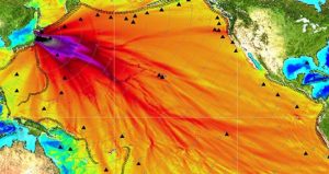
With no back-up power being available, the pumps that are necessary to cool the reactors were not able to work. Because of this, the plant had three nuclear meltdowns, hydrogen air explosions, and a release of radioactive material. The lack of cooling also caused the pool to overheat due to the decay heat from the fuel rods. Scientists and creators of this new radiation mapping zone hope to bring back a sense of peace to the community around the Fukushima Nuclear Power Plant.
So far, there have been no fatalites that are linked to this nuclear explosion, which is the most significant explosion since the Chernobyl disaster in 1986. That doesn’t mean that locals are not getting sick or experiencing side effects from the radiation that was omitted. This new U.K.-developed drone will allow scientists and researchers to go deeper into the core of the nuclear station.
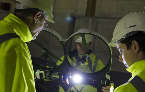
The Remote Intelligence Survey Equipment for Radiation or RISER drone is a quadcopter that can map radiation. It uses software created by Createc and hardware developed by Blue Bear. This drone will be able to provide researchers with a 3D map of the contaminated area. This UAV has the ability to use a laser to safely fly to through the radioactive plant so that it doesn’t have to rely on GPS.
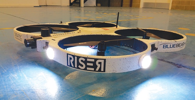
The RISER drone was funded by the Nuclear Decommissioning Authority (NDA) as well as Innovate U.K. The drone itself is about 3 feet in diameter and is equipped with an obstacle avoidance system. The RISER radiation-mapping technology has already been implemented in the reactor site in Fukushima. This new drone from Blue Bear will allow unexplored areas to be analyzed.

Kennedy Martinez
kennedy@dronethusiast.comKennedy Martinez is a resident writer who joined Dronethusiast at the beginning of 2019. She has years of experience reviewing drones and other tech products. When it comes to flying drones, Kennedy loves the ability to create artistic videos from a unique point of view. Kennedy enjoys researching new drones and other exciting products that are available to consumers which is why she is committed to creating the best buyer's guides for our readers.


